 Current
Location:
Current
Location: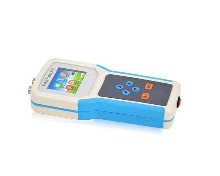
 +86 17853698681
 WhatsApp
 Product Details
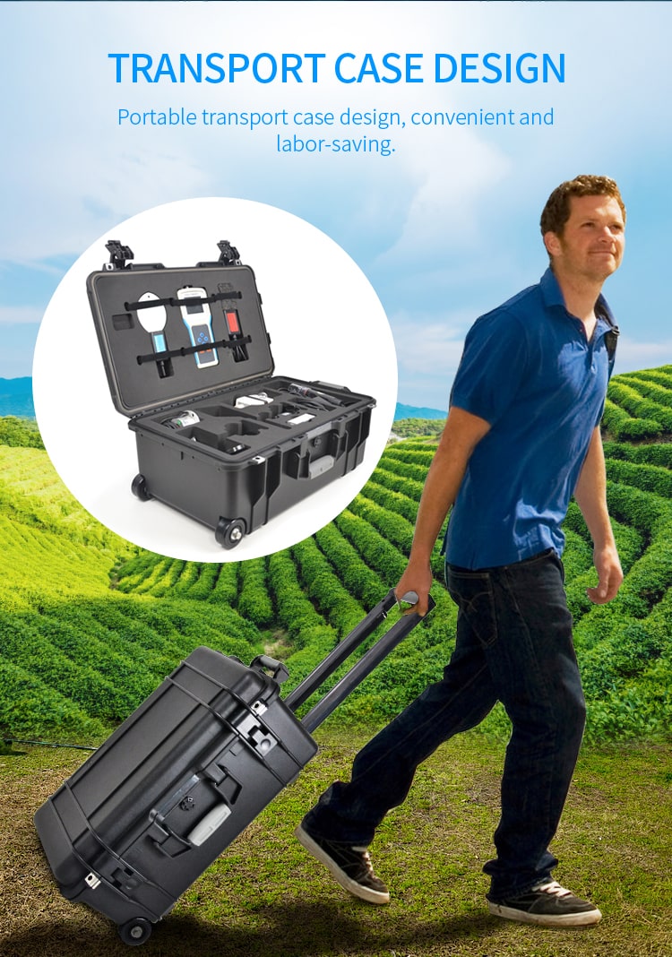
Brief description:
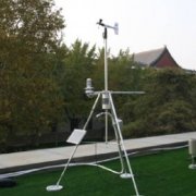
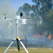
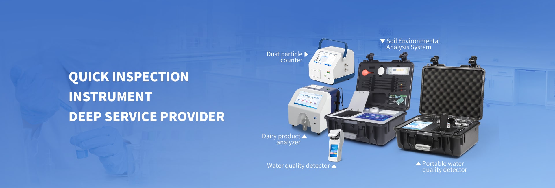
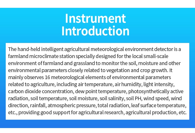
The handheld intelligent agricultural meteorological environment detector is specially designed for the local small-scale environment of farmland and grassland. It is a farmland microclimate station for monitoring environmental parameters such as soil and water vapor that are closely related to the growth of vegetation and crops. It mainly observes 12 environmental parameter meteorological elements related to agriculture, including air temperature, air humidity, light intensity, carbon dioxide concentration, dew point temperature, photosynthetically active radiation, soil temperature, soil moisture, soil salinity, soil pH, wind speed, wind direction, etc., providing good support for agricultural scientific research, agricultural production, etc.
Technical parameters:
Air temperature range: -30~70℃ Accuracy: ±0.2℃ Resolution: 0.01℃
Air humidity range: 0~100% Accuracy: ±3% Resolution: 0.1%
Light intensity range: 0~200Klux Accuracy: ±5% Resolution: 0.1Klux
Carbon dioxide measurement range: 0~2000ppm Accuracy: ±3% Resolution: 0.1%
Dew point measurement range: -20~+50℃ Accuracy ±0.5℃ Resolution 0.1℃
Photosynthetically active radiation range: 400~700nm Sensitivity: 10~50μv/μmolm-2s-1
Soil temperature measurement range: -40~120℃ Accuracy: ±0.2℃ Resolution: 0.01℃
Soil moisture measurement range: 0~100% Accuracy: ±3% Resolution: 0.1%
Soil salt range: 0-20ms Accuracy: ±2% Resolution: ±0.1ms
Soil pH measurement range: 0-14 Measurement accuracy: ±0.2% Resolution: 0.1
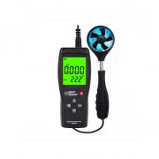
Wind speed measurement range: 0~30m/s Accuracy: ±0.5% Resolution: 0.1m/s
Wind direction measurement range: 16 directions (360°) Accuracy: ±0.5% Resolution: 0.1%:
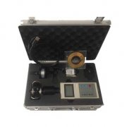
Configurable GPS module, GPRS module, SMS module, MAX485
Outstanding performance:
Adopting integrated structure design, built-in GPS module, GPRS module, external SD card, it can accurately measure the geographical information of the measured location. In addition to displaying the measured environmental parameters and stored data, the interface can also display the latitude and longitude of the measuring point. Upload the environmental factor measurement data of the measured point through the built-in GPRS with one click. At the same time, the data can also be exported directly to the computer through the external SD card. (Optional)
This machine is small and beautiful, easy to operate, reliable in performance, and extremely convenient to carry in the field. After the host is connected to the sensor, the record can be stored manually or the sampling interval can be set arbitrarily through the host to automatically store the recorded data.
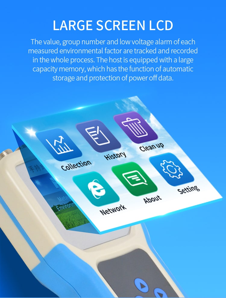
The large-screen Chinese LCD display tracks and records the values, groups, and low voltage alarms of each measured environmental factor throughout the process. The host has a built-in large-capacity memory that can store 300,000 data and has a power-off data automatic storage protection function.
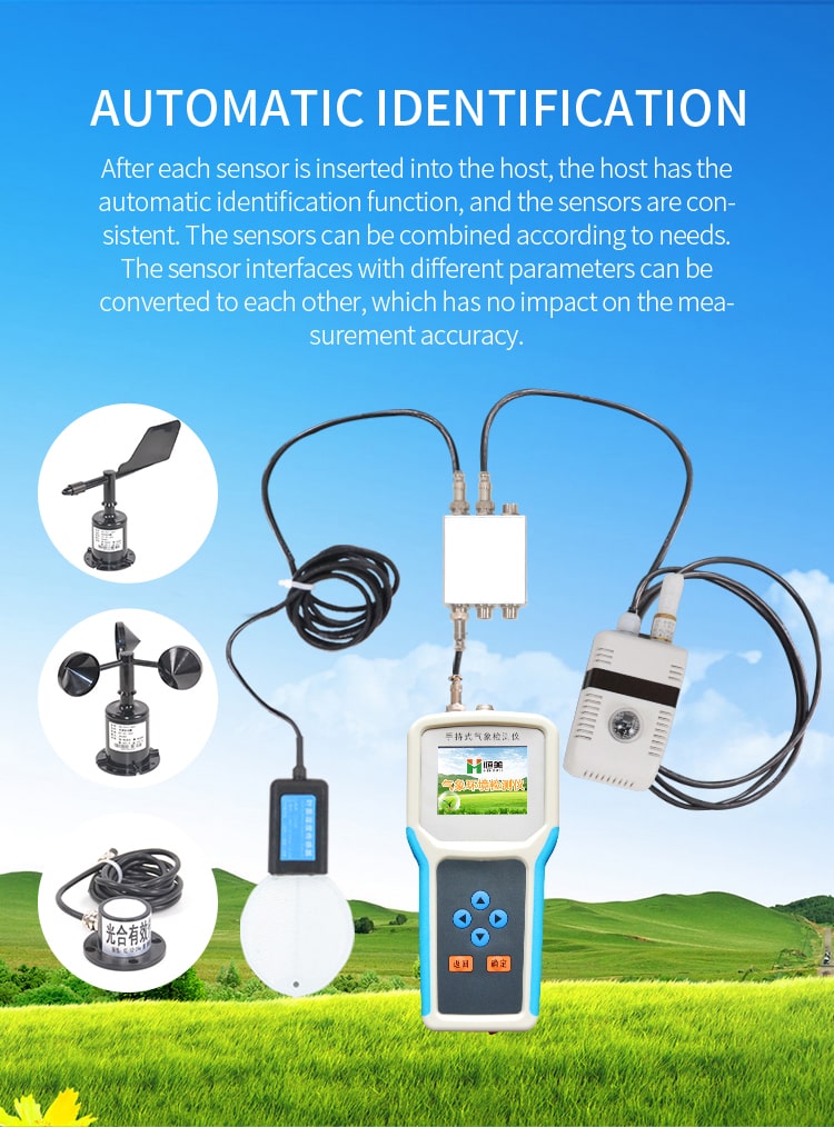
After each sensor is inserted into the host, the host has an automatic recognition function, the sensor consistency is good, and the sensors can be combined according to needs. The sensor interfaces of different parameters can be converted to each other, which has no effect on the measurement accuracy.
The instrument has a multi-channel automatic detection expansion function, which can realize the synchronous detection of multiple sensors connected at the same time.
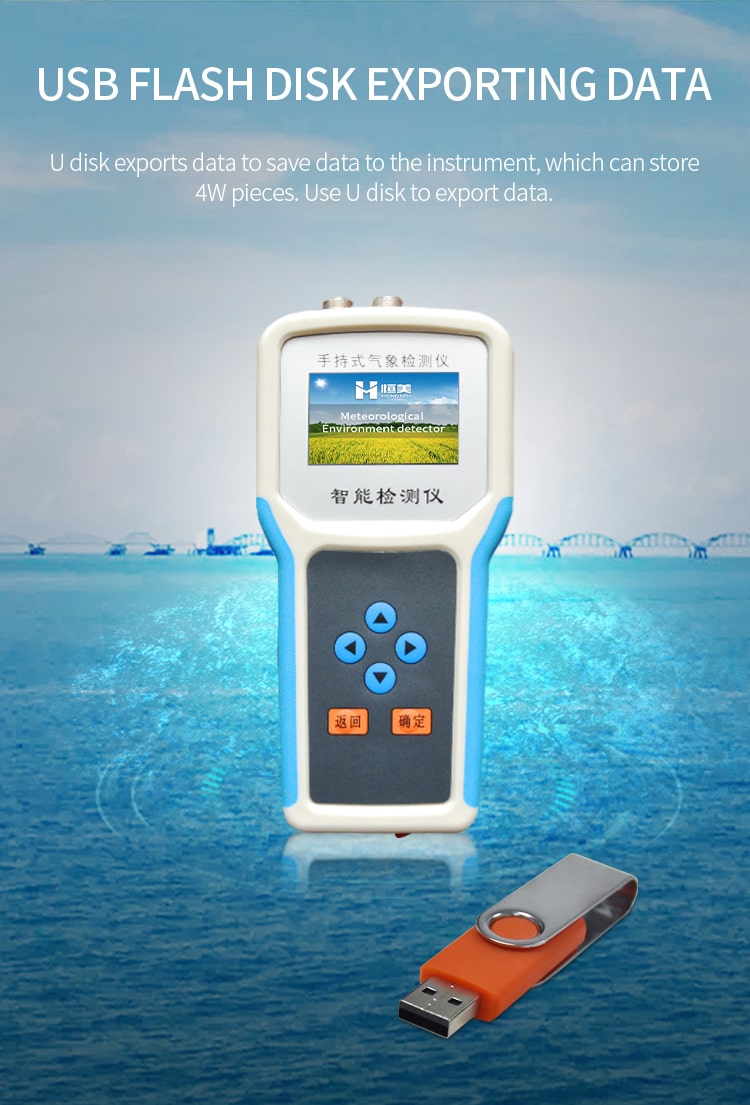
The central station software is powerful. The data is uniformly collected, processed, and analyzed through the central station software. The recorded data can be exported to the computer through the USB interface at any time, and can be stored as an EXCE table file to generate data curves for further data processing by other analysis software. It has the function of setting the coloring of the over-limit area, and the color change warning of over-limit data can be used as a basis for environmental evaluation.
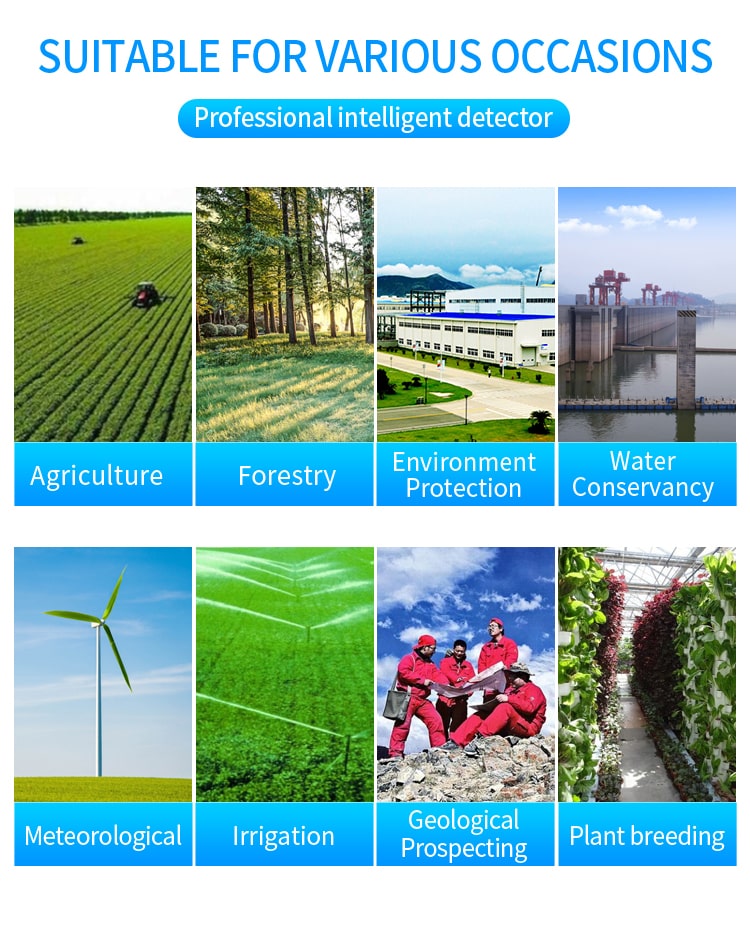
Scope of application:
Widely used in agriculture, forestry, environmental protection, water conservancy, meteorological industry, dry farming water-saving irrigation, geological exploration, plant cultivation and other fields.
 Related Products